Welcome to the Earth Reform Podcast. Today we’re talking about something you’ve never seen, and almost certainly rely on every day: the water under our feet.
Here’s the short version. All over the world, we are pumping water out of the ground much faster than nature puts it back. In some places, that water took thousands of years to collect. And when it’s gone, the ground itself can sink, permanently. Whole cities are already doing it.
Why should that matter if you live nowhere near a sinking city? Because the same underground water grows a big share of the food in your grocery cart. The same sinking ground cracks pipes, roads and foundations, and not every insurance policy will cover the damage. We’ll also meet the people who feel it first, and the wetlands and wildlife that quietly vanish along with the water. Let’s dig in.
The Hidden Savings Account
Think of groundwater as a savings account that nature tops up very slowly. Rain and snowmelt soak down through soil and rock and fill the tiny gaps between grains of sand and gravel. That underground reservoir is an aquifer. In wet regions it refills every year. In dry regions, it can take thousands of years. Scientists call that old water “fossil” groundwater. Across the High Plains of the United States, about 330 cubic kilometres of groundwater had been drained by 2007, mostly in the central and southern parts, where the water is fossil water that mostly collected over the last 13,000 years, which is essentially since the end of the last ice age. [1]
Now we are withdrawing faster than nature deposits. In 2024, researchers led by the University of California, Santa Barbara published the largest check-up of the world’s aquifers ever attempted. They analysed about 170,000 monitoring wells in more than 40 countries, grouped into 1,693 aquifer systems. [2] Water levels were getting deeper by more than 10 centimetres a year in 36% of those systems, and by more than half a metre a year in 12%. [2] Where records were long enough to compare eras (542 systems), the decline sped up after 2000 in about 30% of them. [2][3]
The pattern in the data is the revealing part. Rapid declines were almost entirely absent from land that isn’t farmed, and irrigation accounts for about 70% of global groundwater withdrawals. [4] This is mostly a food story, not a drinking-water story, and that is exactly why it reaches people who have never seen a well.
Cities That Are Sinking
Mexico City is the clearest case. The metro area, home to roughly 22 million people, [5] was built on the bed of Lake Texcoco, where the Aztec capital Tenochtitlan once stood. Over the last century, pumping drained the water out of the clay-rich lakebed beneath the city. Without that water holding things apart, the clay’s tiny grains have been repacking more tightly, and the ground shrinks. [6]
Here is the part that surprised scientists. A 2021 study combined 115 years of ground surveys with satellite and GPS data and found sinking of up to 50 centimetres a year, roughly constant since 1950. The rate did not track today’s pumping. It tracked how thick the squeezable clay layer is. [6] The compaction is almost entirely irreversible, and the authors forecast about 150 more years of it, adding as much as 30 metres to the several metres the city has already dropped. [6] In plain terms, that lost elevation is not coming back.
Newer satellite data keeps confirming the scale. NASA’s NISAR satellite measured some districts, including the main airport and the Angel of Independence monument, sinking about 2 centimetres a month between October 2025 and January 2026. [5] NASA’s imagery works out to roughly 25 centimetres a year on average, and a geophysicist at Mexico’s national university says the city has dropped more than 12 metres in under a century. [7]
The damage is visible. Historic buildings such as the Metropolitan Cathedral tilt, and the cracking reaches sewers, gas lines, water lines and the subway. [5][6] One study of the metro found that nearly half of its elevated segments are sinking unevenly. [8] The fractures also let contaminated surface water seep down, and salty, polluted water squeezed out of the clay now flows into the productive aquifer, worsening water quality in a city where clean water is already hard to secure. [6]
Jakarta is a similar story with a different trigger. Millions of residents rely on groundwater, and it is being consumed far faster than it is replenished. [9] With little open ground left, rain runs off to the sea instead of soaking in. [10] In the worst districts the land drops up to about 10 inches (25 centimetres) a year by one account, [8] and a UNESCO-backed analysis in Science found rates above 25 centimetres a year in parts of Indonesia, Iran and several Mexican cities. [11] Estimates vary by neighbourhood and by study.
Indonesia’s response includes a ban on groundwater extraction by large buildings, announced to take effect in 2023, [10] and an entire new capital, Nusantara, on Borneo. One analysis puts that project at about US$32 billion and warns that restricting groundwater without affordable public water alternatives can leave poorer residents without water. [12]
Neither city is an outlier. The same Science analysis estimated that about 19% of the world’s population and 12% of global economic output could face a high probability of subsidence, with about 86% of the exposed people in Asia. [11]
Your Grocery Cart Runs on Aquifers
About 60% of irrigation in the United States depends on groundwater, [1] and two regions do much of the heavy lifting: the High Plains, which stretches from South Dakota to Texas over the Ogallala aquifer system, and California’s Central Valley. Together they account for roughly half of all US groundwater depletion since 1900. [1] The High Plains supplies about a quarter of the nation’s agricultural production. [13] The Central Valley’s southern end, the San Joaquin Valley, supplies world markets with almonds, grapes, pistachios, citrus fruits and tomatoes. [14]
The drawdown is not even. About a third of High Plains depletion has happened under just 4% of its land area, mostly in the central and southern parts where little water recharges the aquifer. [1] The same 2012 study warned that, at the rates then current, about 35% of the southern High Plains would be unable to support irrigation within 30 years. [1]
A more recent finding makes it feel closer. A Nebraska-led study in Nature Water combined 30 years of water-level and crop-yield data for corn and soybeans. It found that an aquifer can look like it still has plenty of water while yields are already suffering, because a thin aquifer cannot deliver water fast enough for crops. The losses escalate as the aquifer thins, and one author noted that by the time wells signal a problem, farmers have little time to respond. [15] In Kansas, the state geologist has warned that at current irrigation demand the aquifer will be drained within decades. [16]
It also goes global. A 2017 Nature study, using 2010 data, tracked the groundwater depletion embedded in internationally traded crops. About 11% of the non-renewable groundwater used for irrigation is tied to food that crosses borders, and Pakistan, the United States and India together account for about two-thirds of that. Rice (29%), wheat (12%) and cotton (11%) lead the list. [17] Large parts of the world’s population live in countries that get 90% or more of certain staple imports from places depleting groundwater to grow them: about three-quarters of people for maize and a third for wheat and rice. [17]
What does that mean for your wallet? No study here gives a price forecast, so we won’t pretend to. But the mechanism is plain. If the places that grow staples run short of affordable water, supply tightens, and everyone who buys from them shares the risk, including shoppers far from any aquifer. Farmers feel it first: where irrigation fails, crop insurance costs climb and whole rural communities lose income. [15] The lead author of the trade study warns of lost farm jobs and possible food shortages if these trends continue. [17]
Your House, Your Roads, Your Insurance
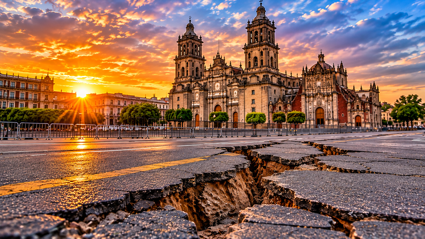
If you don’t live over a stressed aquifer, it is tempting to file this under someone else’s problem. Three things say otherwise.
Home values. A University of California, Riverside study matched satellite measurements of sinking ground with nearly 200,000 home sales across eight San Joaquin Valley counties. It estimated about US$1.87 billion in lost housing value due to subsidence. Buyers shy away from unstable ground, and cracked foundations, buckled roads and insurance limits deepen the drop. [14] Separate reporting on the research puts the typical hit at about 6% of a home’s value, rising to 8.1% where the sinking is severe. [18] (The study was listed as forthcoming in Land Economics when it was announced in July 2025.)
Infrastructure. Canals, bridges, pipelines and rail lines are built level. When land sinks unevenly, they crack, tilt or lose capacity. In 2015, AP reported that parts of the California Aqueduct, which carries water about 400 miles to Southern California, had sunk nearly 13 inches. One Central Valley canal rebuild cost US$4.5 million, and replacing a single bridge that now sits below the waterline was expected to cost US$2.5 million. Experts said the total is hard to pin down because districts rarely separate subsidence repairs from routine maintenance. [19] Those are public works, paid for by taxpayers and water users.
Insurance. Standard homeowners policies usually do not cover subsidence damage. [18] Physical damage from earth movement is typically excluded from first-party property coverage, [20] and because the sinking is slow, with no single dramatic event to claim against, coverage gaps are easy to fall into. Insurers have called subsidence an underestimated risk. [21] In practice, if you own a home on ground that is slowly sinking, the repair bill is often yours.
This isn’t only a California or Mexico story. A global estimate puts about US$8.17 trillion, roughly 12% of world economic output, in areas with potential subsidence exposure. [11] Closer to home for many readers, satellite data show a long stretch of the US Atlantic Coast, about 29,000 square miles, sinking up to about 2 millimetres a year, affecting up to 14 million people and 6 million properties. [8] That sinking has mixed causes, including groundwater extraction, natural processes and the weight of buildings, and when it combines with rising seas it raises flood risk. [18]
The First to Run Dry
Falling water tables do not hurt everyone equally. The person with the shallowest well feels it first, and shallow wells tend to belong to people with the least money.
In the western United States, a Stanford-led analysis of about 2 million well records across 17 states estimated that roughly 1 in 30 wells was dry between 2013 and 2015, and as many as 1 in 5 in some farming areas. In California’s Central Valley, household wells are typically tens of metres shallower than irrigation wells, so while big farms drill deeper, rural families run out first. [22] A global analysis in Science estimated that between 6% and 20% of the world’s wells sit within about five metres of the water table, so a modest further drop would dry them out. A commentary alongside it noted that as water tables fall, only relatively wealthy users will be able to afford deeper wells and the power to pump from them. [23]
Drilling deeper is an expensive stopgap. A new private well can cost tens of thousands of dollars in California, takes more energy to pump, and tends to hit saltier water. [24] A working paper hosted by a UC Davis economist found that when heat and drought hit, farmers drill more irrigation wells, which raises the number of household wells that fail. One person’s adaptation becomes another person’s loss. [25] A 2023 review of Central Valley groundwater plans found that more than 5,000 household wells could go completely dry and over 9,200 could fail in some way, with low-income and Latino communities hit hardest. [26]
India shows the same pattern at far greater scale. A PLOS Water study tracking drinking-water borewells in two village councils near Bengaluru found average depths rising from 183 metres in 2001 to 2011 to 321 metres in 2011 to 2021, with the yearly electricity cost of pumping about four times the yearly cost of drilling new borewells. The authors point to free farm electricity as a major driver. [27] Other analyses are more mixed and see subsidies as one factor among cropping patterns, geology and hours of power supply. [28] What several studies agree on is who pays. In Punjab, small farmers are hit harder by falling water tables. [29] In Telangana, about 90% of small and marginal farmers do not own an irrigation well, and the free power benefited medium and large farms more than the smallholders it was meant to help. [30]
Drying Wetlands, Disappearing Wildlife
Springs, wetlands, stream baseflow and some forests depend on groundwater seeping up to the surface. Scientists call them groundwater-dependent ecosystems. Lower the water table and the supply stops. A global map published in Nature found that more than half (53%) of these dryland ecosystems sit in regions where groundwater is declining, while only about 21% sit on protected land or under sustainable groundwater management policies. They remain extensive and intact in places like Central Asia, the Sahel and South America, but are depleted and fragmented in North America and Australia, where pumping and irrigation have taken their toll. [31] The same springs and wetlands sustain rural livelihoods, and the authors examined the Sahel, where they support biodiversity and rural livelihoods in politically unstable regions. [31]
Even where aquifer levels look stable, pumping can cut the flow of nearby streams. [3] A 2025 modelling study of Australia found that wetlands and river ecosystems received groundwater for fewer months a year in 2001 to 2019 than in 1979 to 2000. The authors caution that this alone does not show ecosystems were lost, and that climate variability explains part of the change. [32]
Nevada shows what that looks like on the ground. A study of about 6,500 wells found that roughly 40% had significant declines over three decades. About 70% of habitats that rely on shallow groundwater, such as wetlands and playas, sit close enough to wells to be at risk. The state has 242 wetland-dependent species, 143 of which are found only in Nevada. [33] One of them, the Pahrump poolfish, had to be moved out of its native Manse Spring in the 1970s once it was clear the spring would run dry from pumping. It rebounded after relocation but remains endangered. [33] In California, sinking land has also held up work on a fish passage for the San Joaquin River restoration project. [19]
What About Canada?
Groundwater is easy to overlook in a country famous for lakes and rivers. Roughly 10 million Canadians, including about 80% of the rural population, rely on it for everyday needs. [34] Everyone on Prince Edward Island does. [35]
There is some reassurance. The 2024 global aquifer study did not find significant declines in the Canadian aquifers it analysed. [36] But there are cautions. Canada records very little data on groundwater supply or depletion, so the picture is thin, and a Prairie drought from 1999 to 2003, similar in intensity to the Dust Bowl era, saw many wells run dry. [37] One of the study’s authors also pointed out that demand for groundwater can be driven by international markets, so a region that looks fine today is not automatically safe. [36] Canada also appears among the ten largest importers of groundwater depletion embedded in traded crops, based on 2010 data. [17] More recently, drought on the East Coast in the summer of 2025 left some homeowners refilling empty wells, and analysts note that Canada holds about a fifth of the world’s fresh water but only a small share of it is renewable. [38]
It Isn’t Inevitable
The same data that sounds the alarm also shows exits. The 2024 aquifer study found cases where depletion slowed or reversed after policy changes, managed recharge and surface-water diversions, including Arizona’s Central Arizona Project, which diverts Colorado River water to refill a basin. [39] Tokyo suffered serious subsidence in the early 20th century and largely solved it by regulating groundwater, according to the lead author of the global subsidence map. [11] In Kansas, a modelling study found that cutting water use now could extend the aquifer’s life and still raise net agricultural production through 2110. [40]
Incentives matter, and they can point the wrong way. Free farm power in India encourages pumping, and modelling for Punjab suggests removing the energy subsidy would cut groundwater use by 29% to 82% depending on the crop, though profits would fall. [29] A solar-pump programme designed to pay farmers for selling spare power to the grid, giving them less reason to over-pump, has not been widely adopted. [41] Jakarta shows the risk of aiming rules at the wrong target: a ban on wells at large buildings makes sense, [10] but restricting poor households’ wells before piped water exists would leave them without it. [12] California’s 2014 groundwater law gives local agencies until the 2040s to balance withdrawals and recharge, and researchers say progress is slow. [14]
Our take is that the approach that best fits this evidence is firm limits and monitoring aimed at the largest users, paired with incentives such as support for efficient irrigation and aquifer recharge, rather than making ordinary households pay for a problem they did not create. That is Earth Reform’s perspective, not a finding of the studies cited above.
One More Surprise: A Wobbling Planet
Pumping groundwater has done something stranger than sinking cities: it has nudged the planet’s axis. Moving water from aquifers to the oceans shifts mass around the globe, and a 2023 study in Geophysical Research Letters found that this redistribution is needed to explain how Earth’s rotational pole drifted between 1993 and 2010. A climate-model estimate puts the groundwater moved in that period at about 2,150 gigatons, enough to raise sea level by roughly 6 millimetres. Without it, the model missed the observed pole drift by about 78 centimetres. [42] The shift is far too small to disturb the seasons, since the pole naturally wanders several metres in a year, but it shows how large the volume of water we move has become. [42]
That’s the water under our feet: a savings account built over thousands of years and spent in a few decades. The bill arrives as sinking cities, wells that run dry for the people with the least money, wetlands that quietly disappear, and costs that show up in food supply, home values and repair budgets.
The encouraging part is that this is one of the more fixable environmental problems we face. Where limits and smart incentives have been put in place, aquifers have slowed their decline and sometimes recovered. The hard part is acting before the ground decides for us, because once it compacts, there is no going back.
Next time you pass a farm field or a city street, remember how much of what holds it up is out of sight. Thanks for listening to the Earth Reform Podcast.
Footnotes and Sources
Numbers match the bracketed markers in the text. Peer-reviewed papers are listed first with their journal; where a news or university summary was the page read for the figures, it is named too. Some studies were read through such summaries rather than the full paper.
- Scanlon, B. R., et al. (2012). Groundwater depletion and sustainability of irrigation in the US High Plains and Central Valley. Proceedings of the National Academy of Sciences, 109(24), 9320-9325. doi:10.1073/pnas.1200311109. USGS record
- Jasechko, S., et al. (2024). Rapid groundwater decline and some cases of recovery in aquifers globally. Nature. 625, 715-721. doi:10.1038/s41586-023-06879-8. Figures checked against the open-access full text; press summary: Springer Nature news release via Scimex.
- Tasoff, H. (2024, January 24). Global groundwater depletion is accelerating, but is not inevitable. UC Santa Barbara news, reprinted.
- Groundwater levels around the world are dropping quickly, often at accelerating rates. Inside Climate News, January 24, 2024.
- ScienceAlert report on NASA NISAR satellite measurements of Mexico City subsidence. Published 2026; measurements cover October 2025 to January 2026.
- Chaussard, E., et al. (2021). Over a century of sinking in Mexico City: No hope for significant elevation and storage capacity recovery. Journal of Geophysical Research: Solid Earth. doi:10.1029/2020JB020648. Summary: O’Hanlon, L. (2021). The looming crisis of sinking ground in Mexico City. Eos, 102.
- Why Mexico City is sinking nearly 10 inches a year, according to NASA. Gulf News.
- Mexico City’s metro system is sinking fast. Yours could be next. Grist. Reports on Solano-Rojas et al., Scientific Reports, and on Atlantic Coast subsidence work by M. Shirzaei and colleagues.
- Jakarta, Nusantara, land subsidence and other pressing water challenges. Space4Water.
- Indonesia’s giant capital city is sinking. Can the government’s plan save it? National Geographic.
- Herrera-Garcia, G., et al. (2021). Mapping the global threat of land subsidence. Science, 371(6524), 34-36. doi:10.1126/science.abb8549. Summaries: Deltares release via PreventionWeb; The Guardian, January 1, 2021, via PressReader.
- Indonesia: Can bottom-up resilience save the poor in a sinking city? Global Affairs, May 8, 2026. An analysis piece, not a peer-reviewed study.
- Analysis of High Plains Resource Risk and Economic Impacts (OCIA). Nebraska state reference copy.
- Nemati, M., Dinar, A., & Sneed, M. Impact of land subsidence on housing sale values: Evidence from the San Joaquin Valley, California. Land Economics (forthcoming at time of release). UC Riverside news release, July 31, 2025; aggregate figure from Maven’s Notebook.
- Nebraska-led study in Nature Water on aquifer thickness and crop yields. Coffey, D. (2024, March 8). The High Plains Aquifer is approaching a point of no return. Ambrook Research; see also the University of Nebraska summary.
- Plains producers search for solutions as Ogallala aquifer levels continue to decline. Agri-Pulse.
- Dalin, C., Wada, Y., Kastner, T., & Puma, M. J. (2017). Groundwater depletion embedded in international food trade. Nature, 543, 700-704. doi:10.1038/nature21403. IIASA record; crop shares and author comments from Scientific American / PBS NewsHour.
- U.S. cities are sinking. Here’s what that means for homeowners. CNBC via NBC New York. Cites research by M. Nemati (UC Riverside) and Policygenius.
- Damage from sinking land is costing California billions. Associated Press, 2015; companion text at NBC Bay Area.
- Sinking cities: Not just at sea level. JD Supra.
- That sinking feeling. Risk & Insurance, September 14, 2015 (cites Swiss Re SONAR report).
- Perrone, D., & Jasechko, S. (2017). Dry groundwater wells in the western United States. Environmental Research Letters, 12(10), 104002. doi:10.1088/1748-9326/aa8ac0. Stanford Water in the West summary.
- Jasechko, S., & Perrone, D. (2021). Global groundwater wells at risk of running dry. Science, 372(6540), 418-421. doi:10.1126/science.abc2755. Commentary: Famiglietti, J. S., & Ferguson, G. (2021). The hidden crisis beneath our feet. Science, 372(6540), 344-345. doi:10.1126/science.abh2867. Summaries: Mongabay;PreventionWeb.
- Perrone, D., & Jasechko, S. (2019). Deeper well drilling an unsustainable stopgap to groundwater depletion.Nature Sustainability. doi:10.1038/s41893-019-0325-z. Pacific Standard summary.
- Working paper on farmer adaptation, groundwater and domestic well failures in California. Hosted by K. Jessoe, UC Davis. Working paper, not yet peer reviewed as read.
- Thousands of California wells could run dry. Phys.org, September 2023. News report on a study of 60 Central Valley groundwater plans.
- Srinivasan, V., Lakshmikantha, N. R., Manjunatha, G., & Shinde, G. N. (2025). Chasing the water table: The impact of groundwater depletion on rural drinking water supply in peninsular India. PLOS Water. Summary: India Water Portal.
- Agriculture sector not responsible for discoms’ health, declining groundwater: study. Down To Earth.
- Revisiting groundwater depletion and its implications on farm economics in Punjab, India. (2017). Current Science, 113(3), 422. Full text.
- Telangana’s groundwater crisis. India Water Portal.
- Rohde, M., et al. (2024). Groundwater-dependent ecosystem map exposes global dryland protection needs. Nature. Summaries: Phys.org; Earth.com.
- Otoo, N. G., Sutanudjaja, E. H., van Vliet, M. T. H., Schipper, A. M., & Bierkens, M. F. P. (2025). Mapping groundwater-dependent ecosystems using a high-resolution global groundwater model. Hydrology and Earth System Sciences, 29(8). Article.
- Saito, L., et al. Nevada groundwater and groundwater-dependent ecosystems study, Hydrological Processes. Reports: Missoula Current; Idaho Capital Sun, October 27, 2025; The Water Report.
- Backgrounder 136: Water series. C.D. Howe Institute, February 2011 (draws on the 2009 Council of Canadian Academies expert panel on groundwater).
- Groundwater activities. Prairie Provinces Water Board.
- All eyes are on the future of fresh water after a winter of record heat. CBC News, 2024.
- Task Force 3: Groundwater. Action Canada.
- Reflections: Should Canadian cities be worried about their water supply? Canadian Water Network.
- Declining groundwater levels. UC Santa Barbara research summary of the 2024 Nature study.
- Steward, D. R., et al. (2013). Tapping unsustainable groundwater stores for agricultural production in the High Plains Aquifer of Kansas, projections to 2110. Proceedings of the National Academy of Sciences. doi:10.1073/pnas.1220351110. Kansas State news release via Phys.org.
- Running on sunshine but running out of water. Mongabay India, June 2025.
- Seo, K.-W., Ryu, D., Eom, J., Jeon, T., Kim, J.-S., Youm, K., Chen, J., & Wilson, C. R. (2023). Drift of Earth’s pole confirms groundwater depletion as a significant contributor to global sea level rise 1993-2010. Geophysical Research Letters, 50(12), e2023GL103509. doi:10.1029/2023GL103509. Open-access full text; AGU press release.